Drones Quixote
A failed photo attempt with fun consequences
"Drones Quixote" on https://aligot-death.space, available at https://aligot-death.space/txt/misc/drones-quixote-en
Every year around the 8th of December, Lyon (the city where I live) organizes a light festival called “fête des lumières”. It used to simply be about putting lanterns on windows, illuminating the whole city, but as most old traditions, it morphed into a consensual and uninteresting event with no interest other than turning the city center into a walled amusement park with a few massive installations, crowds that would make a pop star agoraphobic, and shit tons of cops and soldiers around it.
But that this year was a bit different: a drone show you say? In the largest park of the city, outside the main perimeter?
These last few months I’ve been into cyberpunk, as I do every other year or so. Lyon is not very vertically developed aside from a few skyscrapers, and of course its hills. But I envisioned something. I finally have long lenses (old & cheap analog 200mm & 300mm), so I jump on every occasion to make a long shot. I wanted to take advantage of the flat city center and surrounding hills to get the skyscrapers and the drones in the same photo and get some locally-sourced cyberpunk visuals.
The overall plan is fairly simple: find a way to get a very squeezed shot of the drone show with some sky-scrapers, industrial buildings and possibly both.
Starting point#
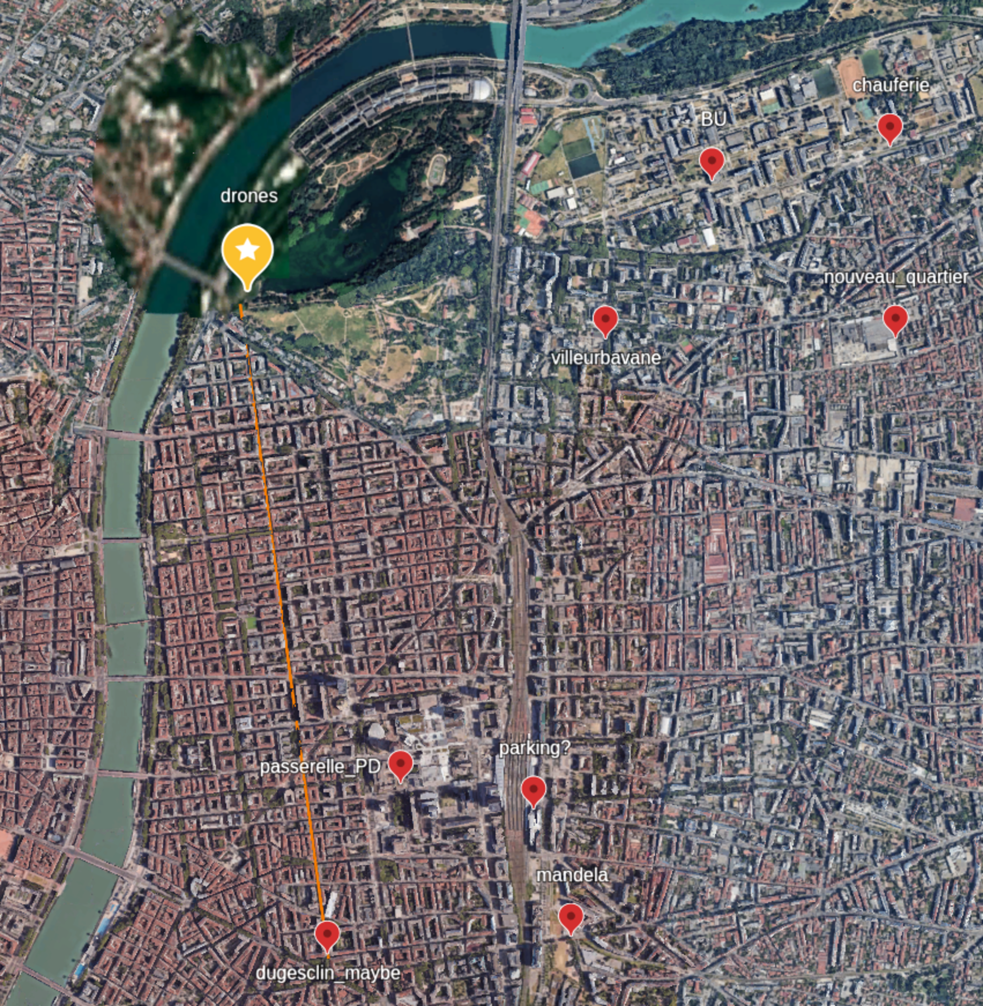
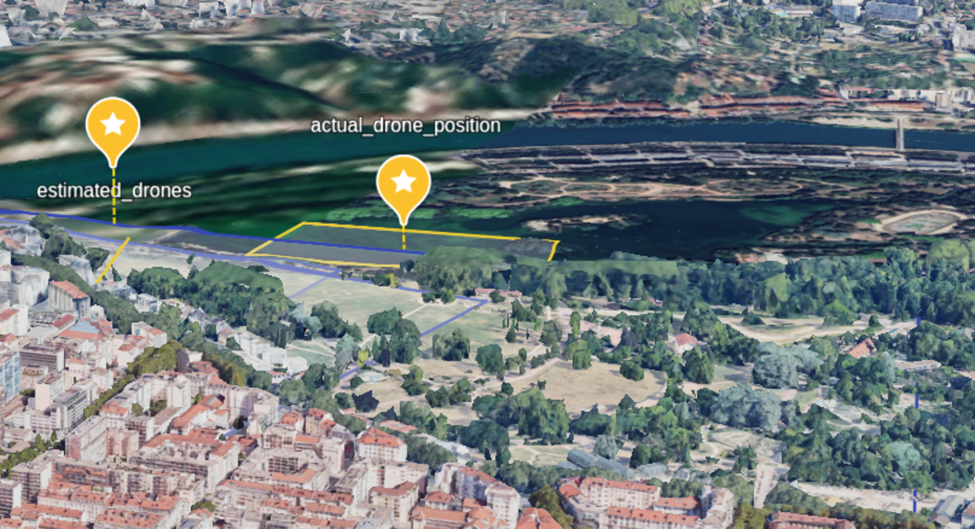
I started researching this a week before. Rather than blindly turning over every stone in the city, I started with a Google Earth project, and added a few known spots I knew.
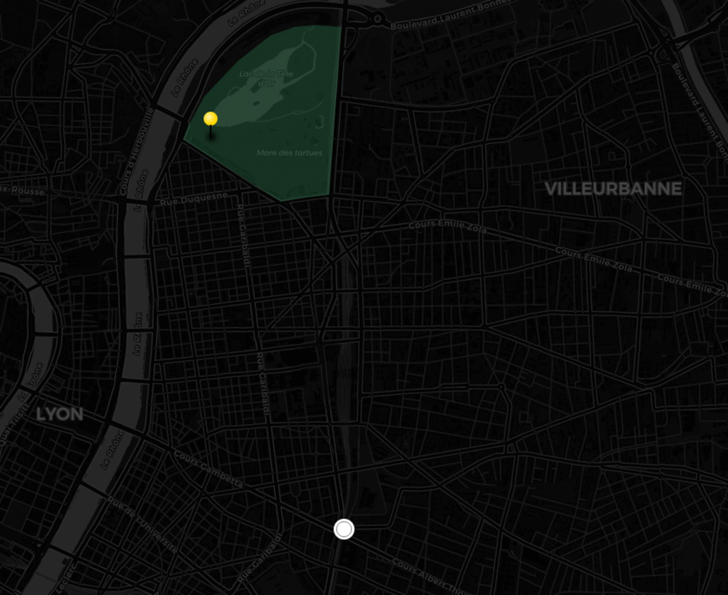
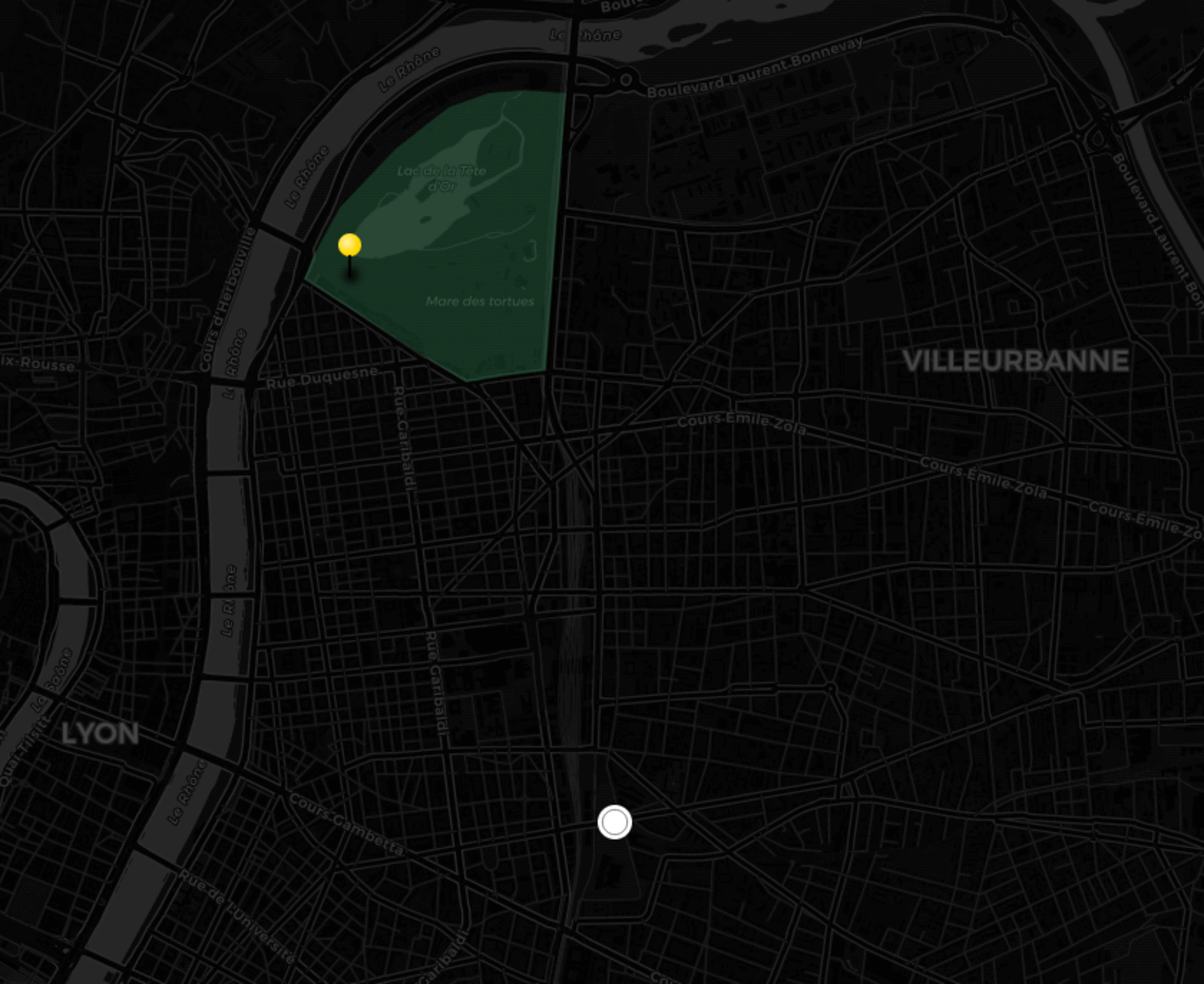
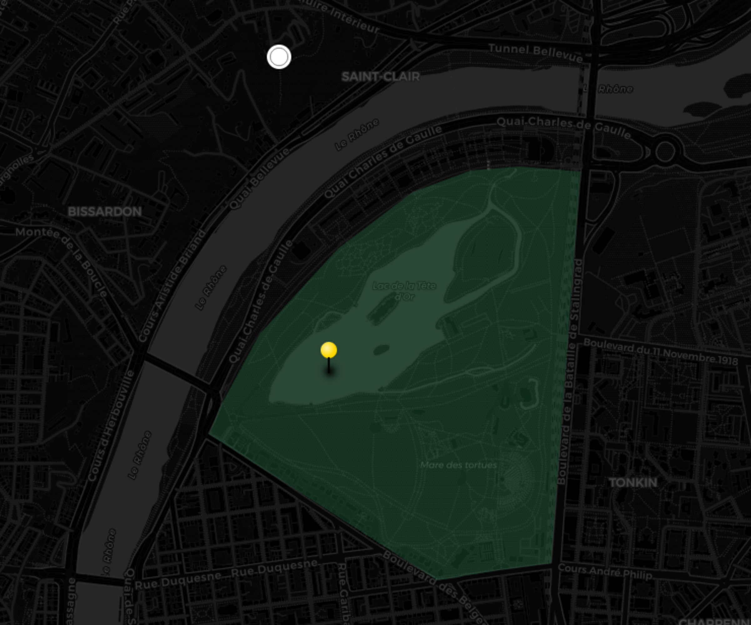
To get my bearing on the drone show, I turned to the official map (archive):
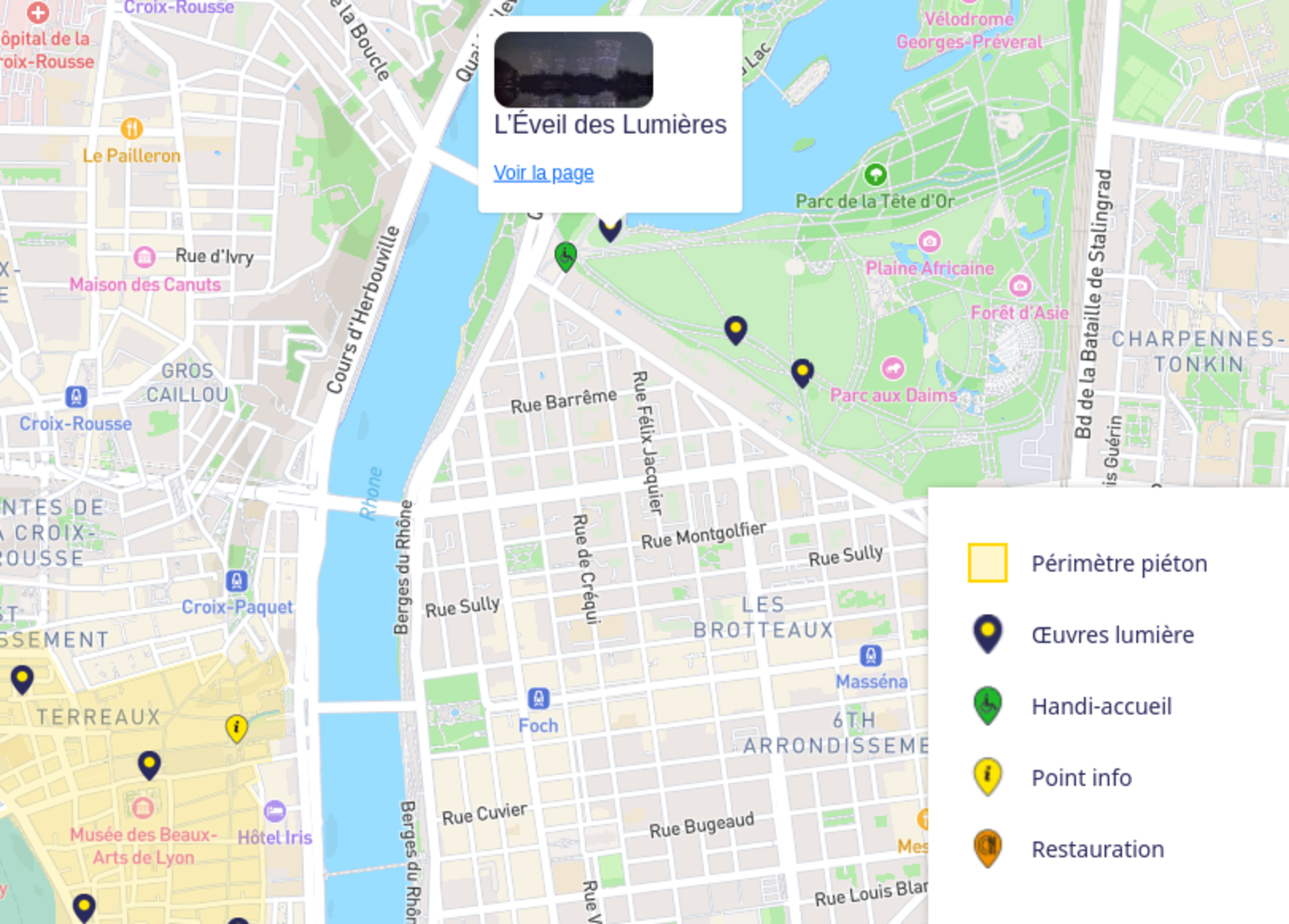
That’s weirdly close to the west entrance, but okay.
(foreshadowing)
In case you’re not familiar with the city layout, here it is:
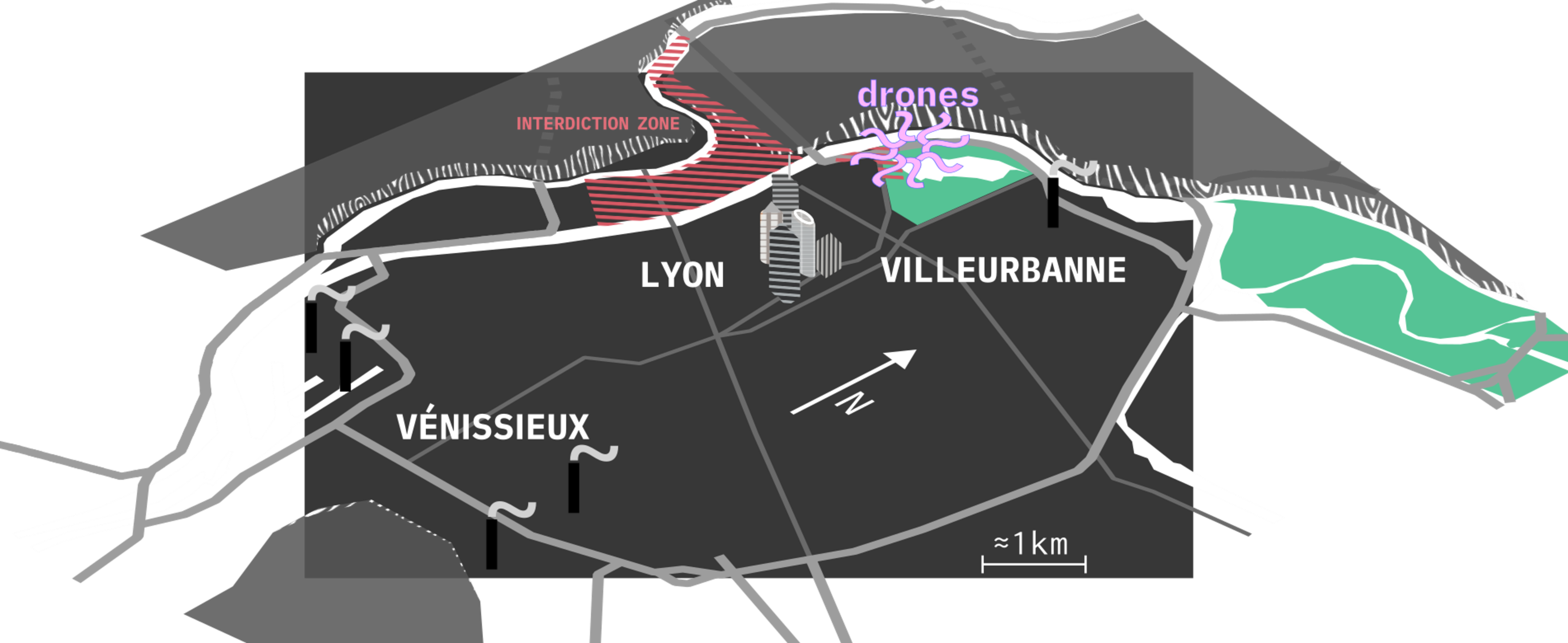
The city is at the junction of two rivers, the Saône and Rhône. It sits in a plain between several hills, the biggest ones being Croix-Rousse & Caluire in the north, and Vieux-Lyon east of it.
What about a second city-center? The first one is mostly the commercial and historic one. But There’s an another one, right in the middle of the flatlands. It's more on the "business" side of things, mostly because of the Part-Dieu train station. And that’s where the skyscrapers are.
Finally, there’s a few industrial zones, mostly south of the city. La Doua campus (east of the park) being a scientific campus, there’s a few interesting structures here as well.
The city center, where most of the shows happen, is on the peninsula. As per tradition, locals either hide in their house or flee the city during the week-end.
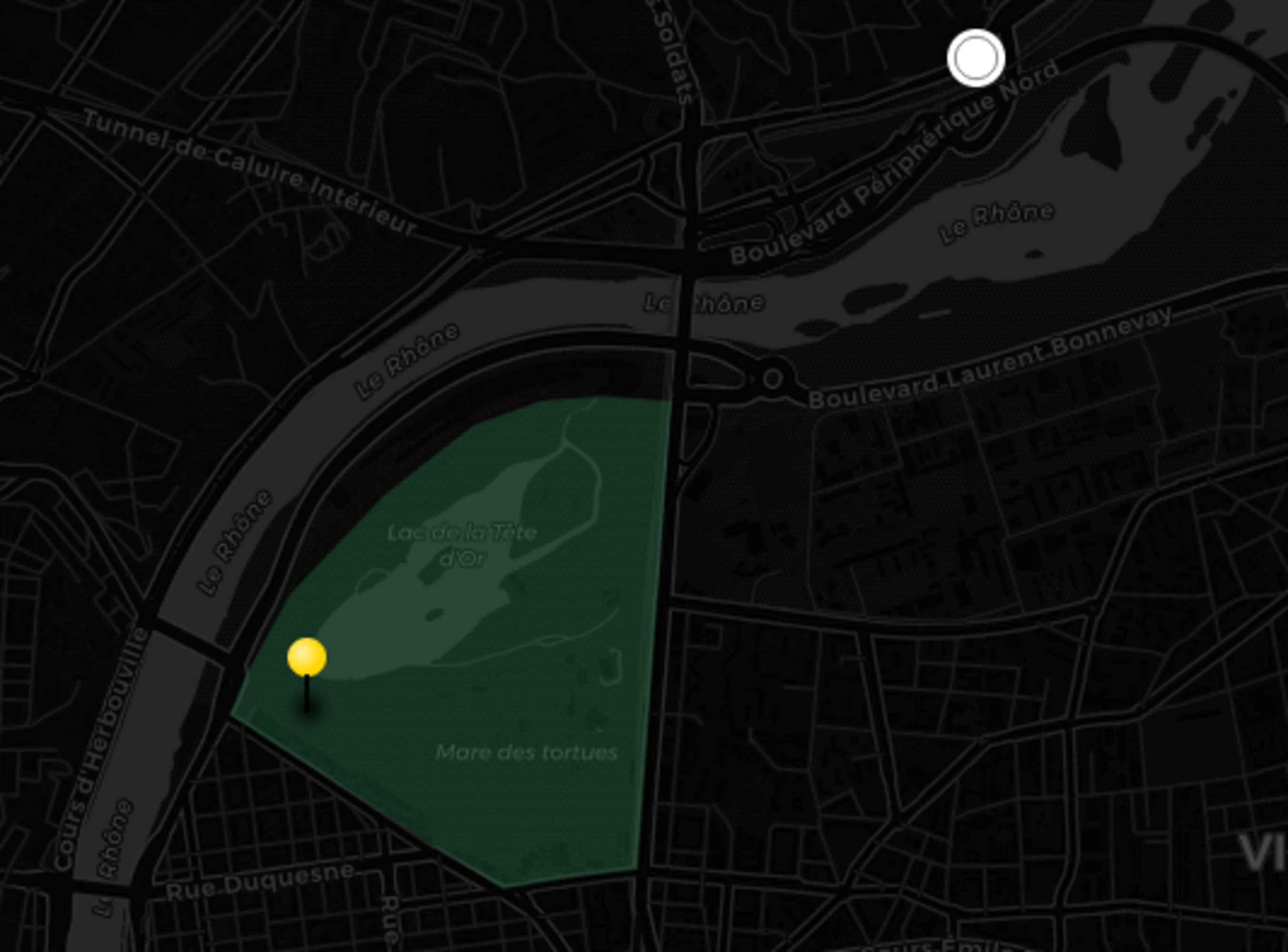
The drone show however happens in an urban park, La Tête d’or (literally Golden Head’s park, or la golden teuté in local parlance), north of the city. It happens every half hour, and lasts 8 minutes.
According to the official website (archive), the show itself includes 500 drones. Based on the diagram on the production’s team website (archive), this points to a flight envelope between 0 and ≈100 meters.
2025-12-01#
J-4
So the name of the game is: get low on Google Earth 3D view, try to find nice looking alignments, and check surrounding spots using Street View.
I basically spent several hours per day doing this on google earth:
Original photo, image created using GenNS (Generative Natural Stupidity)
funny thing: do you recognize this?
That white blurry blob is Interpol’s building. Yes, that Interpol. Lyon is where the pol’ inter’s.
Obviously, The building and the surrounding hills are blurred on google maps and 3D is disabled. This has two goals: increasing security and pissing me off.
And it’s sitting 400 meters from the drone show.
Similarly, I found a nice spot outside of the city, next to an old fort. I really liked it, but then noticed the barbed wires around it. Turns out the Interior minister bought the Fort de Corbas from the army in 1998 to store explosives.
So, I was about to go next to a secured facility (that got robbed of 28kg of semtex in 2008), with a long range camera, right as the city was put under heavy surveillance. What a mastermind.
2025-12-02#
J-3
Ok, ladies, gentlemen, and those of us who know better: it’s time to bike.
I finally got a bike again: a friend of mine gave it to me because they’re moving out.
The goal is to check markers next to Cusset (East), Monchat (South-east), Bron (South-south-east), Manufacture (South of the skyscrapers) and Mandela’s park (South-East of the skyscrapers). That’s one hour of biking in the cold, notwithstanding stops & lollygagging, in the middle of traffic.
The whole trip actually took 4 hours, mostly because I found new spots on the go, partially because I forgot the long lenses on my desk and had to go back home.
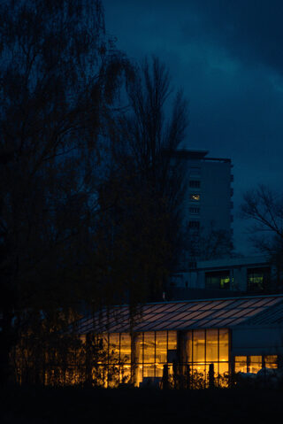
Most of the spots were either uninteresting or not working, but I was able to take that shot:
I love that shot, which is actually why I’m so disappointed that the drones won’t be visible from here (they would be behind the darkest building of the top left corner)
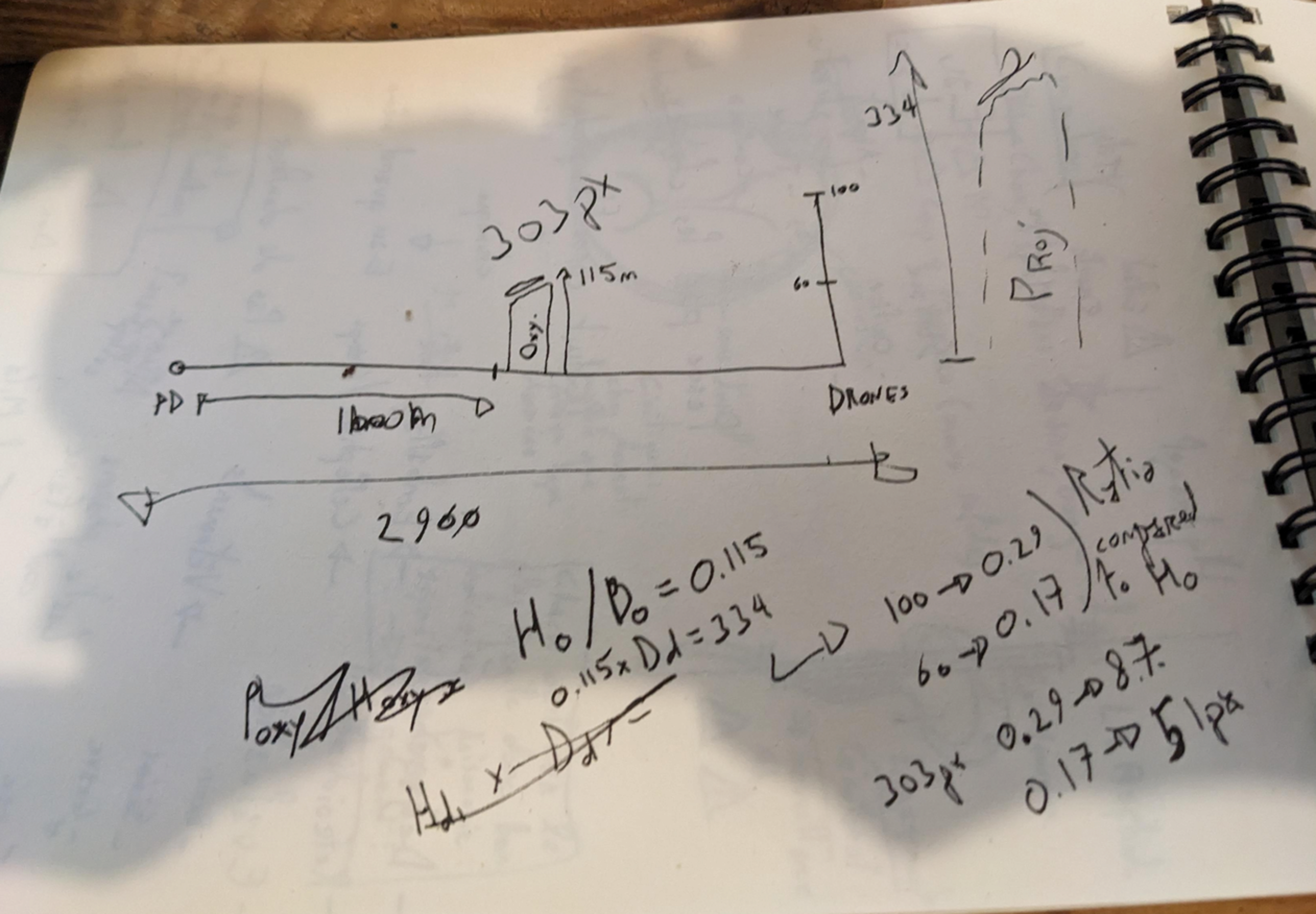
The next day I used these tests shots to estimate where the drones would actually be visible.
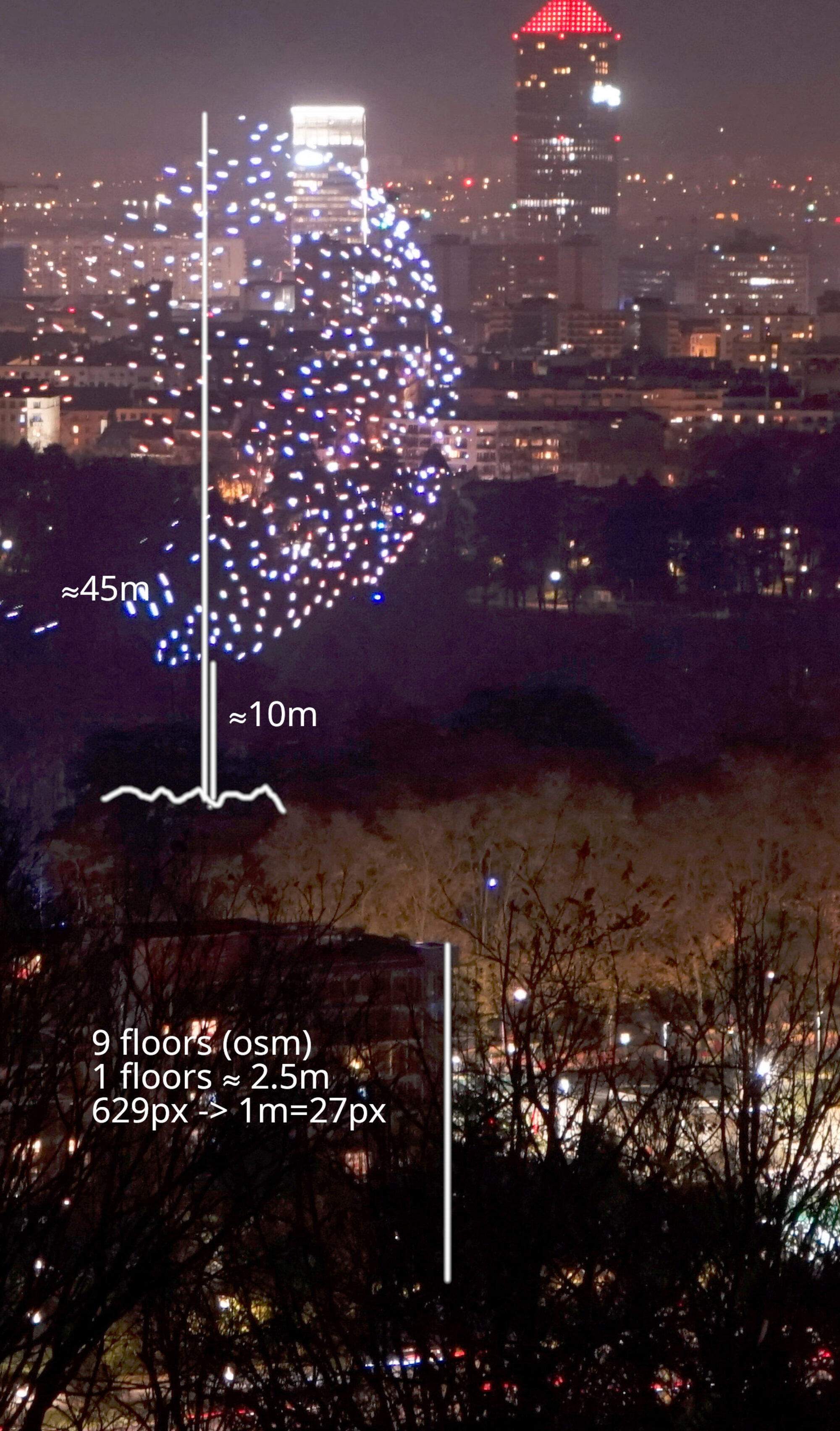
I used an online tool to calculate Point of View width and height at a given distance, and open data (mainly Wikipedia and Open Street Map) to get buildings’ size to use as a vertical ruler.
I also had to resort to dark arcanes: maths.
The maths were very hard, because they were very advanced and surely not because I suck.
Still, I'm satisfied. I wasn’t able to do a proper photo-bike adventure in several years, and realized how much I missed this.
2025-12-05#
Fête des lumières’ first day.
Based on the previous run, I chose to start the first day of the event with the Doua’s Campus (north-east). It’s not the most interesting zone, but it’s not too far from my home, and a fairly safe bet given the low verticality of the neighborhood. After that I want to try a few spots in villeurbanne, and then around the Part-Dieu train station.

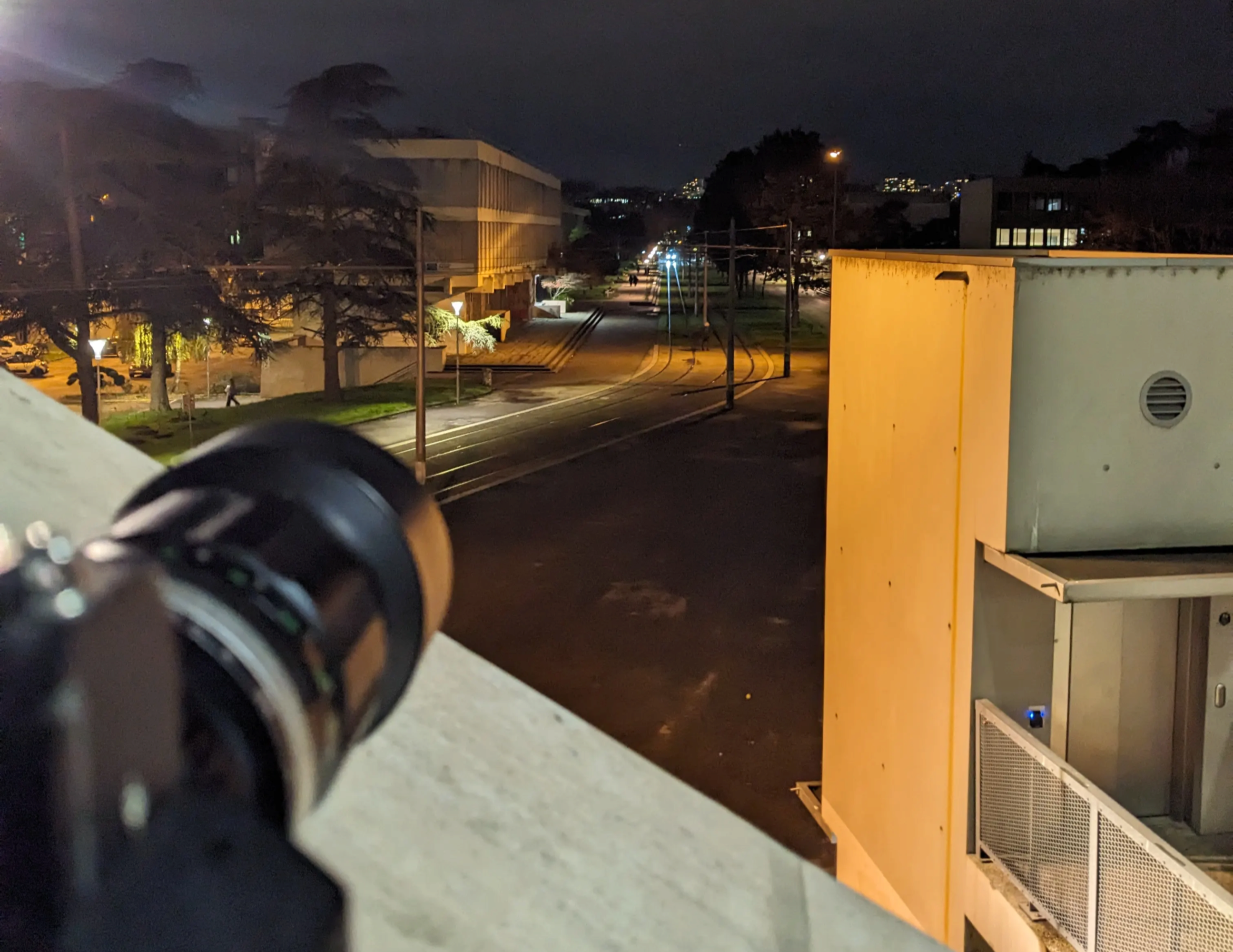
I went scouting on La Doua’s campus for easy spots before sunset
I then went back later, sat on the stairs of the University Library, waiting patiently.
After a while, I noticed some lights above a building:
Oh no.
These drones aren’t where they’re supposed to be. Or rather, where I thought they would be.
After checking my map using the streets and rails as a bearing because my smartphone's gyroscopes are dying (another challenge), I finally understood what was going on.
Something obvious.
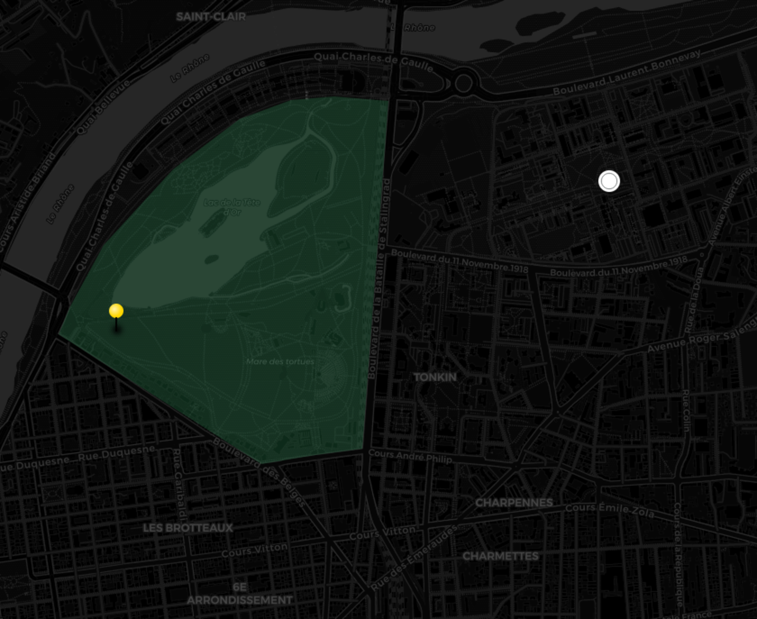
The pin on the official map wasn’t the location of the drone show.
It was where the public is.
The actual show is above the lake, which means the show was a 100m North East from what I had planned (not so critical) but more importantly, a good 20/30m lower than I had anticipated (way more critical given how little wiggle room I had on the vertical axis).
Because of that, a lot of the locations I had painfully found got discarded.
In this moment, I am heartsore. Not because of any phony god's curse. But because, I am flabbergasted by my idiocy.
Freaking out, I tried a shittier spot north of the city, hoping to at least get some data:
But it wasn’t great (as planned, because I’m great at planning).
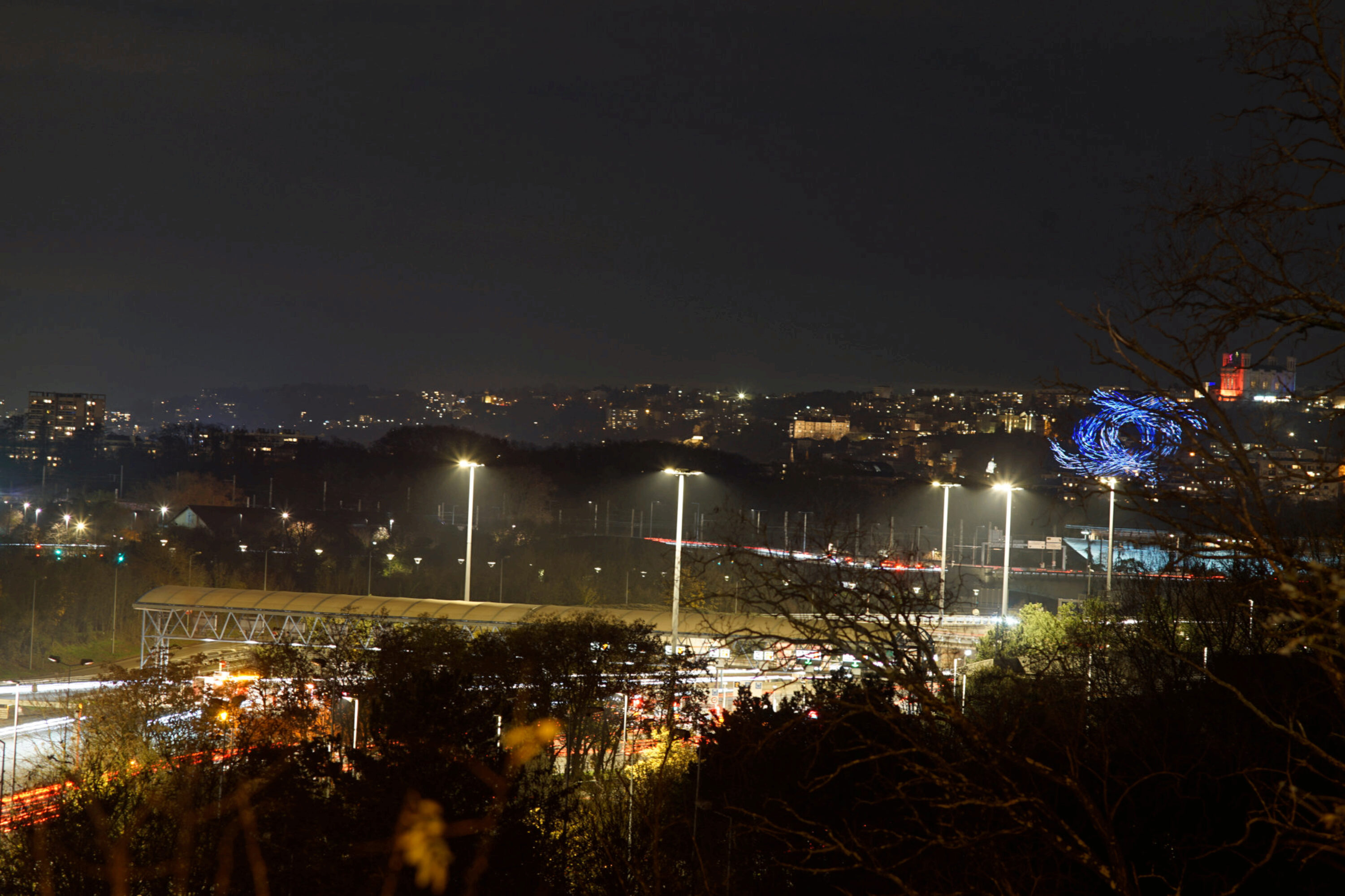
I started roaming aimlessly, looking at the sky. Going down the docks along the Rhône, I saw a park on the map, 90m meters above my position, the road leading to it with an average grade of 13%.
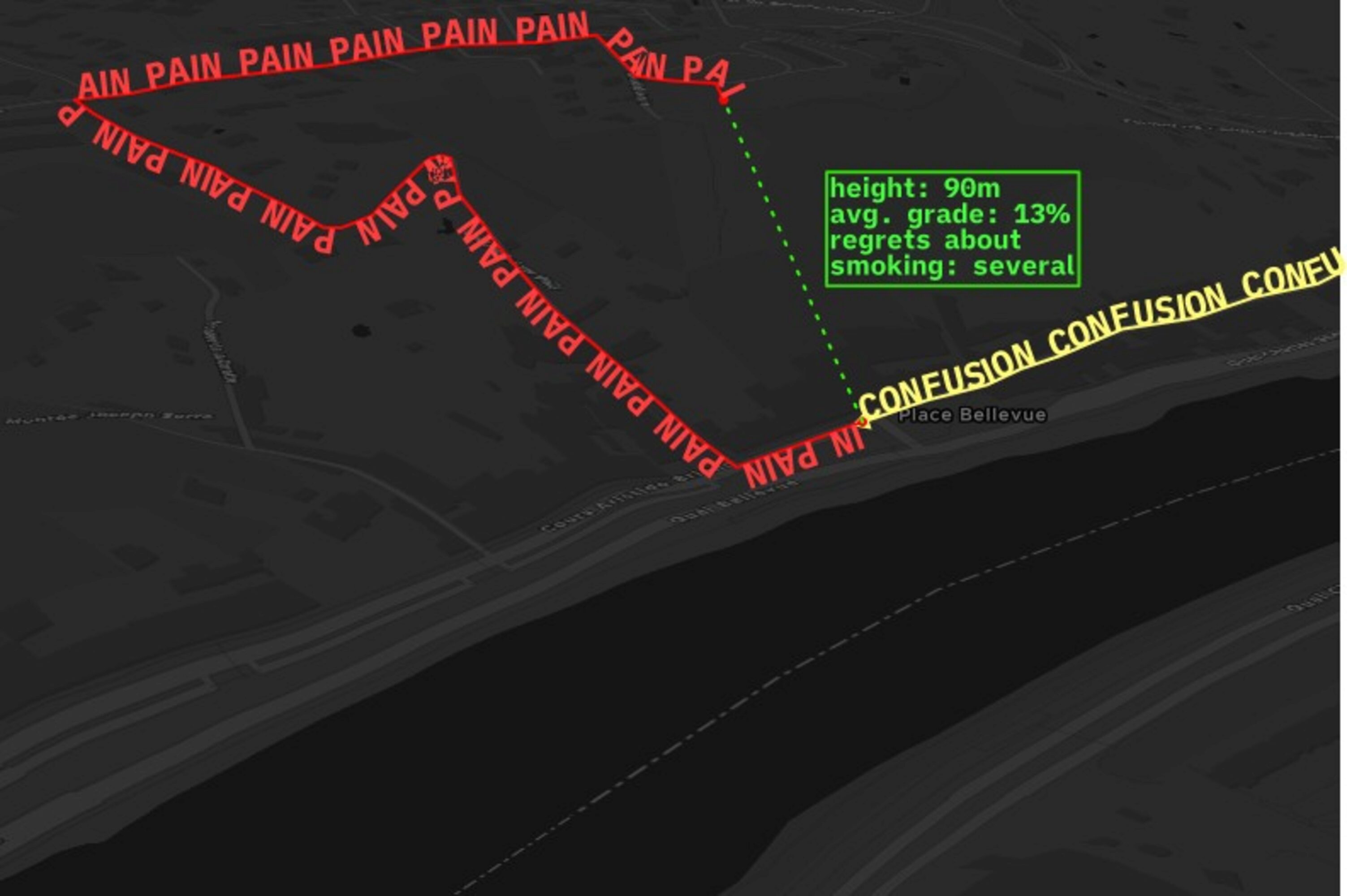
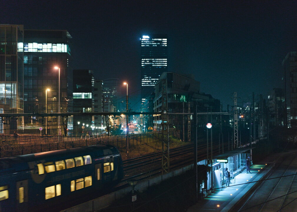
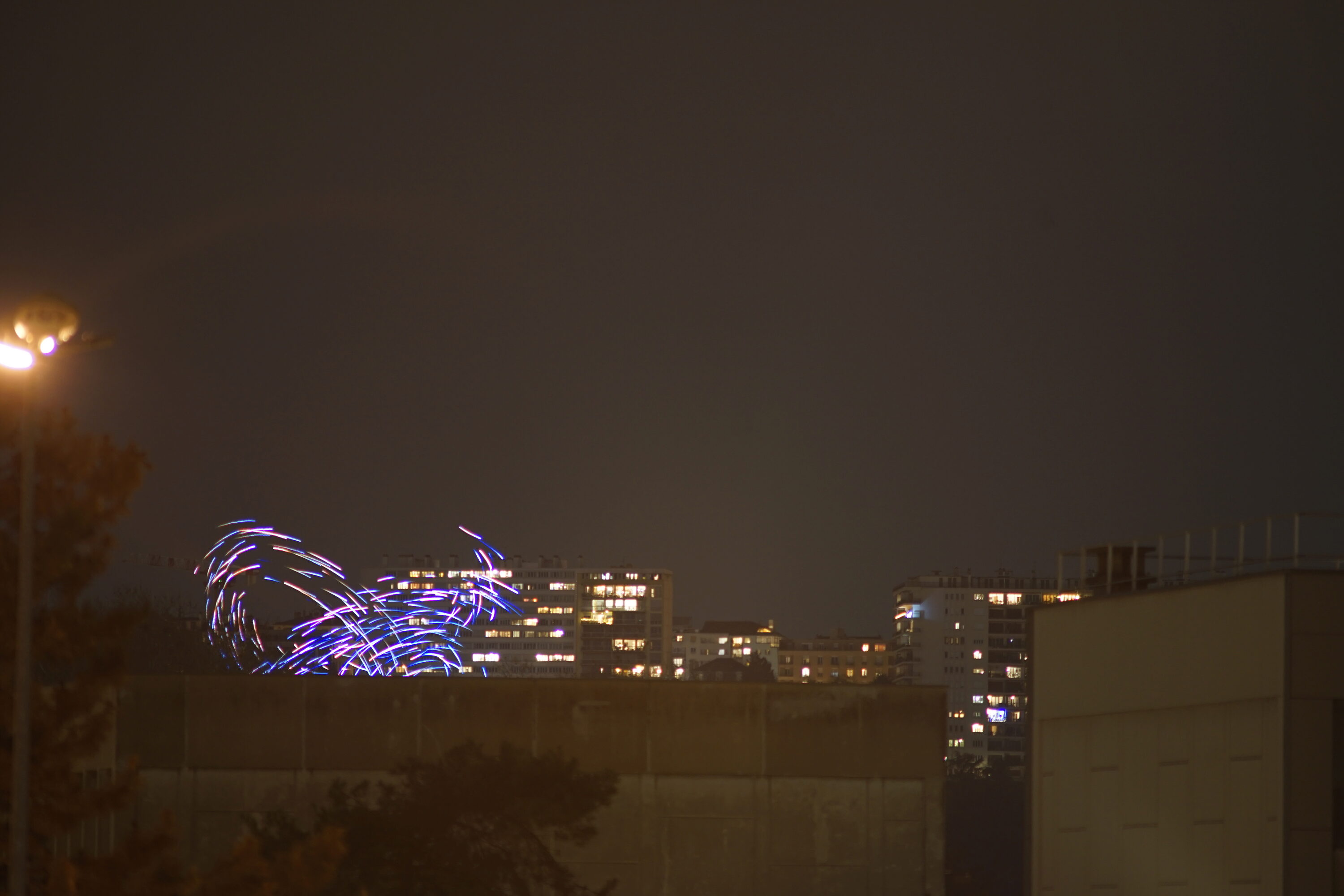
I arrived at Montessuy’s viewpoint, and was greeted by a nice view. Not the one I had envisioned, as it’s the opposite of what I wanted in terms of composition, but still. I waited awhile for the drones to appear, and was able to get that shot:

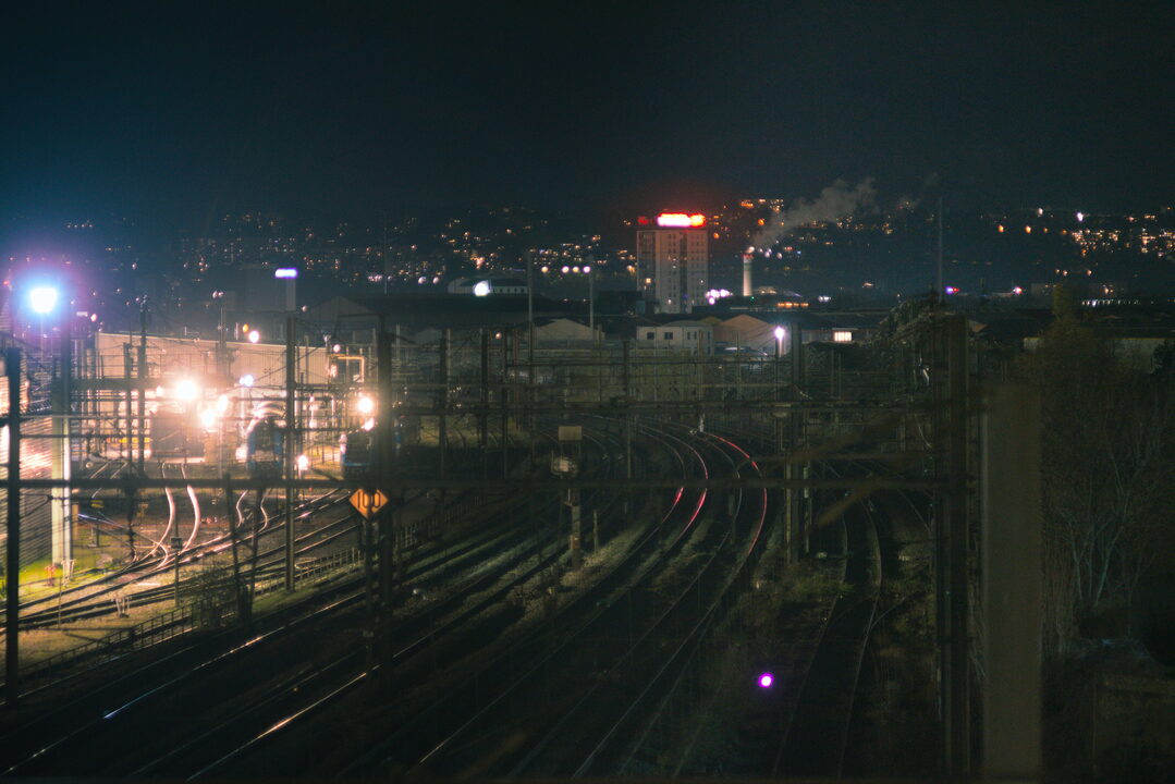
After three or four shows, I decided to take some more picture of the view around me:
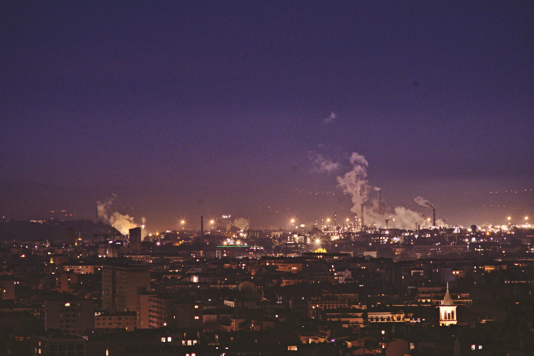
Feyzin Refinery, south of the city.
I went home, fairly happy with what I got, and completely exhausted.
2025-12-06#
Went to a punk show where friends were playing to help, and had a good time.
2025-12-07#
Alright so, while I am happy with what I got, I’m still pissed off that I didn’t get the shot.
What I actually wanted is something lower on the horizon (so not from that hill), some industrial shit and ideally drones behind the skyscrapers (so, from the south of the city).
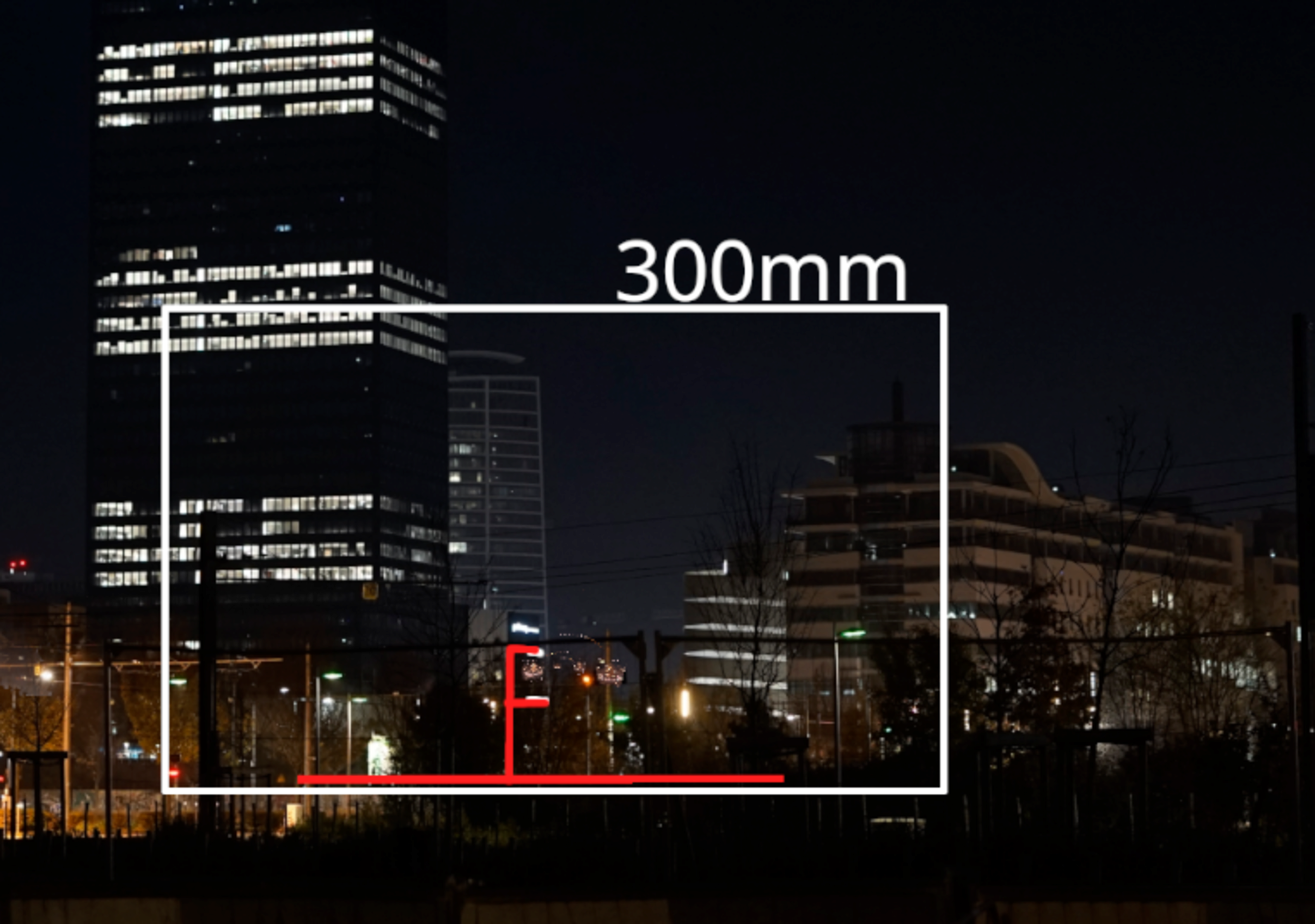
I half-assed some calculations to fix my “simulation” (I was too lazy to take distance into account, I just measured the pixels)
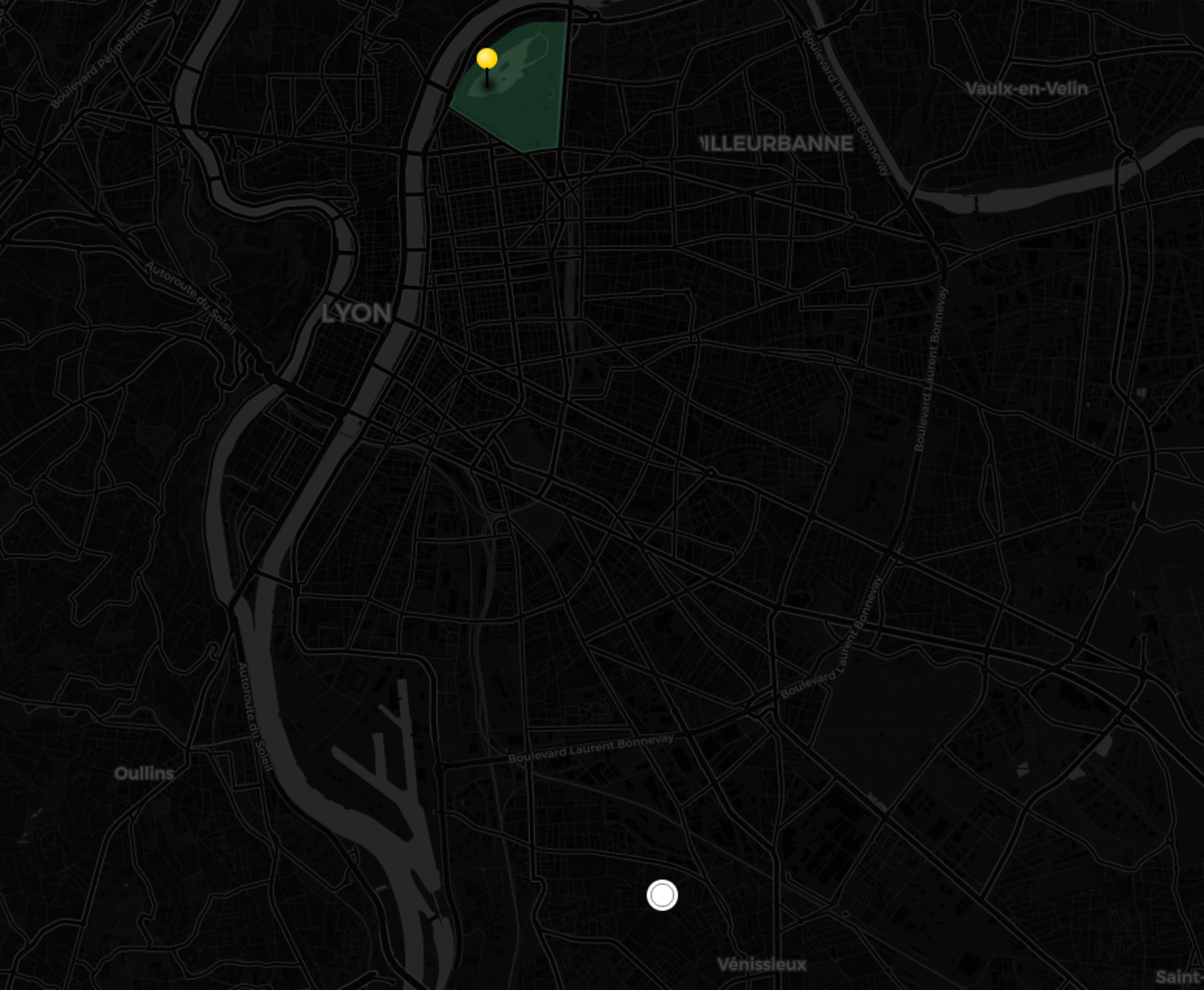
There is two remaining spots: one in vénissieux, and one waaayyyy south-west of Lyon. As I was getting tired, and my calendar was getting a little full for the days to come, I took the decision to focus on vénissieux’s spot.
Again, I cobbled together a rough simulation of what the shot would look like, based on the focal calculator, google earth and google street view

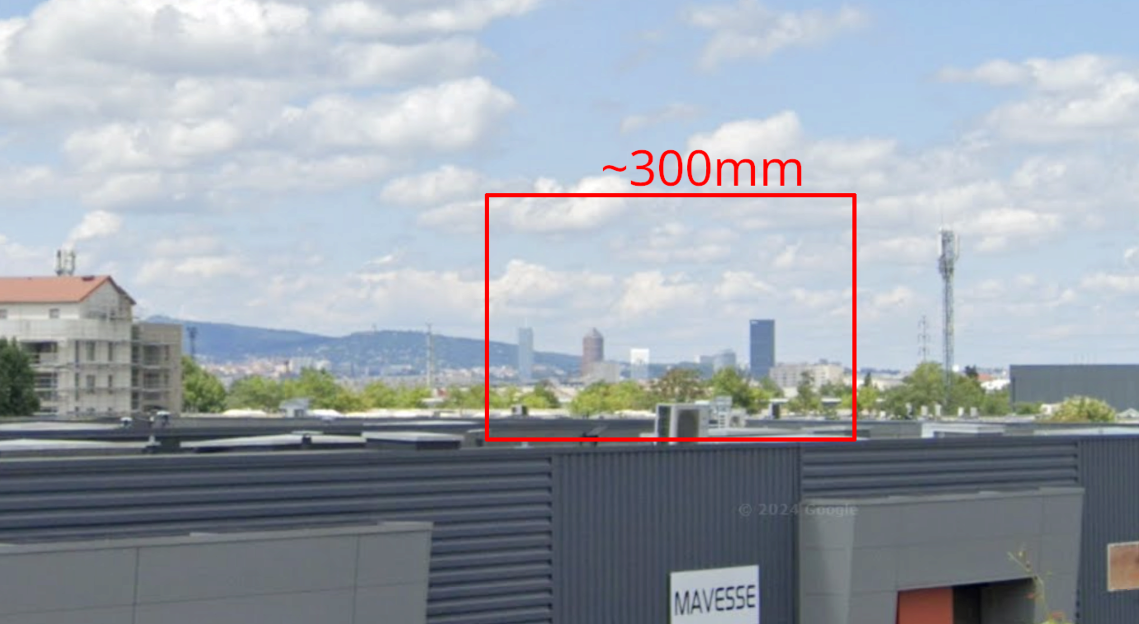
(The actual view should be ~4m higher, because of the park)
After a long bike trip, I ended up in a dark park above vénissieux industrial neighborhood.
Here is what I got:
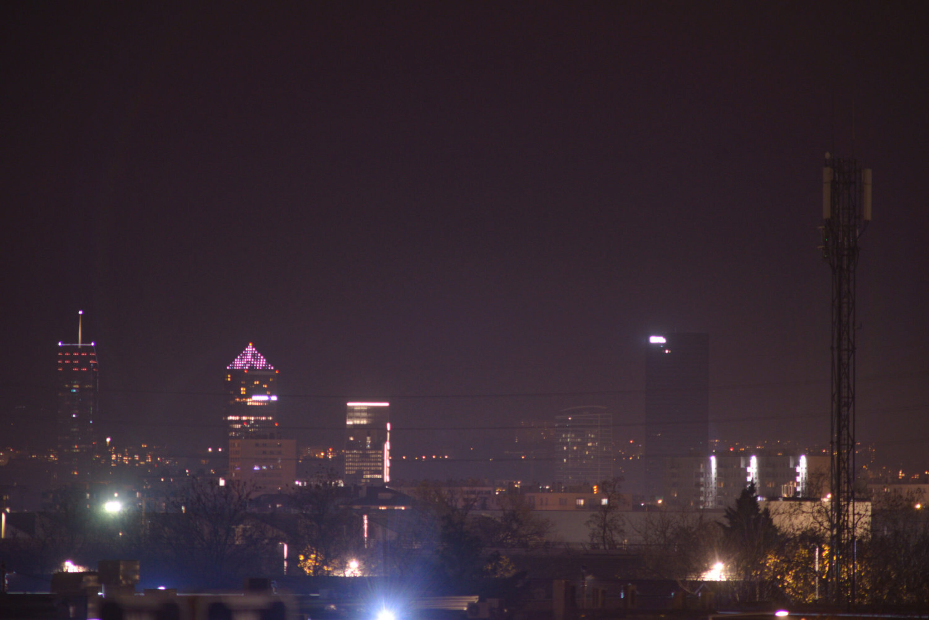
On the positive side: my “simulation” wasn’t too far off.
On the negative side: drones were nowhere to be seen. I waited for an hour and and half, nothing.
Going back home, I found numerous spots for future photos. I also found people having a barbecue in a hidden spot in the middle of an industrial complex while listening to music. It was quite a moment.
So, that was a massive failure regarding my objectives. But it was fun to do, and I actually got some nice photos out of it.
All the photos from that journey are available here

.jpg)